
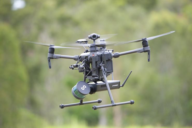
Data61 spin-out start-up Emesent has released its ‘plug and play payload’ Hovermap, which allows drones to fly underground and in other GPS-denied locations.
Hovermap is a self-contained unit consisting of a small processor and a spinning cylinder, about the size of a can of beans, which emits 300,000 laser beams a second.
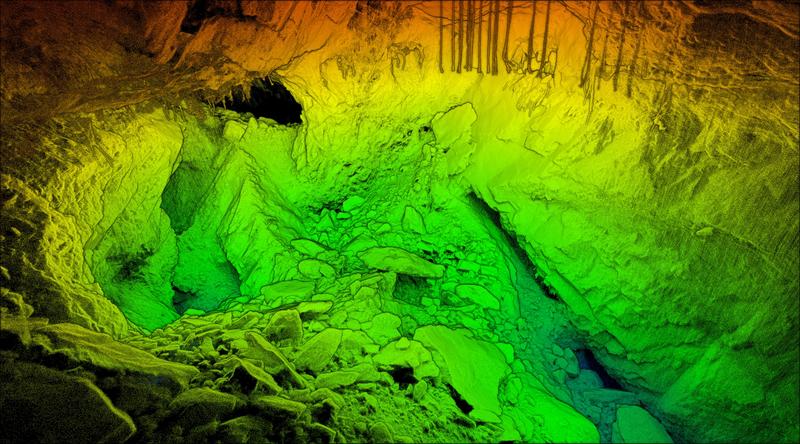
The 1.8kg device features omni-directional LIDAR (Light Detection and Ranging) based collision avoidance and advanced autonomy which allows for beyond line-of-sight missions in GPS-denied environments. Hovermap’s SLAM (Simultaneous Localisation and Mapping) capability means accurate LIDAR mapping can be carried out even when GPS is not available.
“It allows drones to fly autonomously even in GPS-denied environments to collect valuable data that was not previously possible. This provides a step change in the data collection possibilities for mining, energy, construction, asset management and many more,” said Emesent CEO and co-founder Dr Stefan Hrabar.
“There is increasing demand for these industries to digitise and remotely inspect their assets but access to hazardous areas and the lack of GPS has been a limiting factor until now,” he added.
The commercial availability of Hovermap follows more than five years of research and development, which built on a decade of work by CSIRO Data61's Robotics and Autonomous Systems group.
‘Game-changer’
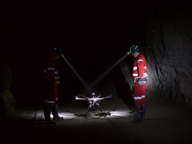
Over the last 18 months, Hovermap has undergone rigorous testing in the field by early adopters in the US, Canada, Australia, China and Japan.
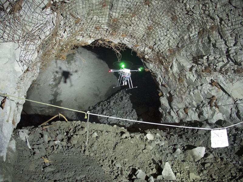
Last year, CSIRO sent a drone fitted with its Hovermap payload 600 metres underground, down a mine in Western Australia.
“We’ve been using Hovermap to fly into inaccessible areas of underground mines to map them,” said Matt MacKinnon, founder of Canadian-based drone services company UAS Inc.
“We’ve conducted more than 60 commercial flights in 12 mines, capturing extremely valuable data for our clients without putting humans at risk. Hovermap truly is a game-changer for underground mining and other GPS-denied environments,” he said.
In November, Emesent raised $3.5 million in venture capital – led by Main Sequence Ventures – to commercialise the product.
Emesent is a partner of Data61’s effort in the US Defense Advanced Projects Agency's (DARPA) new Subterranean Challenge, in which teams are tasked with quickly and remotely mapping, navigating and searching for items in perilous underground environments.
 Credit: Supplied
 In October Data61’s Robotics and Autonomous Systems group was named as one of only seven teams globally to receive up to US$4.5 million from DARPA to compete in the three year contest.
Join the CIO Australia group on LinkedIn. The group is open to CIOs, IT Directors, COOs, CTOs and senior IT managers.